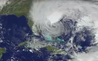
 A variety of news outlets and search engines have made it possible for people to track Hurricane Sandy live via the Internet on desktop and mobile
devices.
Google launched a sharable crisis response map for New York City Sunday to help people track evacuation zones, centers,
and Red Cross emergency shelters related to Sandy, a Category-1 hurricane expected to storm the mid
Atlantic coat Monday evening and Tuesday.
The related map of the Atlantic seaboard supports emergency preparedness information, such as location tracking from the NOAA-National Hurricane
Center, Public Alerts from weather.gov and earthquake.usgs.gov, radar and cloud imagery from weather.com and U.S. Naval Research Laboratory, and storm footage.
advertisement
advertisement
Blogging apps and Twitter
introduced ways to provide live updates of events, but traditional media outlets, such as the Weather Channel, have found ways to use YouTube to broadcast live coverage of the storm.
Sites like TowsonPatch in Towson, Maryland, set up a live chat for local residents to get help. The chat box
pulls in Twitter tweets related to Sandy, including photos that might post, through the #MDSandy or #Sandy hashtag.
Gizmodo also points to five live Web cams placed up and down the eastern seaboard that provides a look
at the storm.
The Wall Street Journal also made its content free and available to all visitors Monday, allowing people to access information about the storm Sandy. Landfall is expected
Monday night, the NYSE delayed earnings reports and options markets closed, and roughly 8,000 airline flights canceled, according to WSJ.
Keep
safe.